There are endless ridges in the Wollemi with no names or that draw any particular attention on a map. There are infinite twisted canyons, crevasses, scrub, bassalt capped mountains, sandstone gorges, rocks, cliffs and caves that cover areas the size of a Northern Territory cattle station. Groups of otherwise unremarkable red contour lines that twist and bend around occasionally named blue lines that denote the creeks and rivers, providing just enough tangible information to navigate the Wollemi on foot if you choose.
Within this seemingly invisible and unknown land are small traces of an extremely long history of human occupation. This history is of a continuous and unbroken connection to the Wollemi that was first brought to worldwide attention less than 10 years ago with spectacular and amazing discoveries of some of the world’s oldest recorded art and cultural histories in the form of ancient Rock Art. To think, as Europeans we believed up until these discoveries that the Wollemi was too rough to traverse or live in – shows just what little understanding we have of such places and their role in Australia’s very long past.
The trip started with the routine drive up Putty Rd to the beginning of the designated Fire Trail that I would use to move west towards the Colo River. After caching the car near Putty Road and then the mountain bike at the end of the FT, I put on the gators, gloves, rolled down the sleeves and reacquainted myself with the prickly scrub. After a few years of good rain, and no major bush fires in the Wollemi for a decade the bush was thick and brutal, or as some claim “impenetrable”. The first 4 kilometers (or grid squares) took 2 hours to bash down to the first creek where I would get water.
I soon found Clews Cave (see Topo) and then proceeded to climb half way up The Island with spot height of 545m before climbing down a narrow pass to the Colo river. This pass drops 280m in just over 300m – close to a 45 degree slope.
 The Island as seen from above Clews Cave
I then progressed downstream to the junction of the Colo and Wollangambe rivers to find a place to camp. The river was high (not that I have a comparison) but looked like a flooded river by its brown disturbed colour. I wrapped the pack up in the hutchie cover and swam across; only to see the best beach in the Wollemi was back on the side of the river I had just come from and 100m downstream. So I swam back across after filling up the water bottles from the fresh looking rapids charging into the Colo from the Wollangambe.
Pic 1. View of flooded Colo at Wollangambe R
Pic 2. Camp Site
 (left beach)
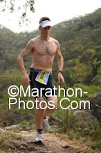
Pic 3. Some bloke from 1943

What a night. No rain, but I could hear the long distance rumblings of storms further up stream. In the morning the river level was lapping up towards my sleeping area, and the stick I had put in the sand to mark the river level was missing, presumed to be down at the Windsor Bridge.

Day 2 started with another crossing of the Colo, then up the Wollangambe for 300m before turning right up a large unnamed creek. After several hundred metres I attempted to venture parallel to the Creek on higher ground to avoid the vines and boulders that made the creek slow and tricky work. I eventually decided to ditch the creek and try my chances climbing up onto Clews Ridge. Bugger me, the scrub had started out nearly impassable and only got worse. Undergrowth usually gets thinner as you rise from a creek, but today it only got thicker. At some stages I could only throw myself into the scrub and then cut myself free of vines that entangled me.
I eventually reached Clews Ridge and then made my way East to the highest easterly spot height on Clews. From here I could see Main Creek to the North and the high point of Clews ridge to the West.
 View of Main Creek from Clews Ridge east
After a bit of sun baking, lunch and a search for sign of human occupation I headed west along Clews. The only sign of human contact was an old head torch laying on a cliff top that I carried out. By now it was 1pm and getting pretty hot. Thoughts of sitting and waiting it out occurred, but I had plenty of water (5 litres) and agreed (with myself) to go slowly to preserve water loss. By 3:30pm I had found a 25m long cave off one of the intermittent tributaries of Main Creek. The cave had 40 hand stencils (including a childs), one stone axe stencil, possibly two boomerang stencils and what looked like some smudged out anthropomorphic figures. The cave also had various stone arrangements that looked like they’d been put there yesterday along with a lump of dirt where you would naturally put the fire. It was obvious the last fire in the cave had been buried by the most recent inhabitants who occupied the cave, possibly as recent as 130 – 200 years ago?
The cave was perfectly located 20 metre in front of two small active waterfalls with fresh water, plus a small wading pool for learn to swim lessons.

 After a few photos and a search for more sites I went and found a camp site for my night ahead. Then that night the rain started, first lightly, then more heavily. By dawn the rain had been joined by thick fog. It was a night spent thinking about ‘what would it be like living out here’.
Day 3 started retracing my steps east along Clews Ridge through unrecognizable bush. Its amazing how less than 24 hrs ago I walked this ridge in the opposite direction, now could recognized none of it, partially due to the fog and rain I was now in.
The gamble.
Instead of taking the 4 hours to retrace the route I had taken to get up onto Clews ridge the previous day, I planned to attempt a rapid descent down a steep reentrant that would take me directly down to the Colo –and save hours of walking.

The risk was, I had 10m of rope, that when folded in half = 5m. Therefore, after any ledge greater than 5m that I roped down meant I was committed to the descent. If I then found a ledge greater than 5m that I couldn’t get down, and I was also unable to climb back up previous ledges I would be trapped between ledges and I would need to trigger the epirb (very embarassing). The map indicated just enough space between the red contours line, but it was still a gamble. The Google Earth image I had, had a big shadow over the re entrant - so it gave no additional information . After 3 ledges (of less than 5 metres) the final ledge was about 10 metres – however I was saved by the fact that a tree of 40 metres had grown beside the last ledge and I could shimmy down it to get down to the Colo. Phew – a small amount of relief.
After another crossing of the Colo I soon headed up The Island and retraced the almost 45 degree climb. Imagine a set of stairs 300m high and that is also a waterfall, that’s what it was like. A great climb. By about mid afternoon I reached Clews Cave and set up camp. Another raining night with cover in a cave, this time in a bigger cave including a small feast of finishing off the last of my food, including half a kilo of Deb mashed potato and a tin of Spam. Day 4 started with an early rise and bush bash back to the MTB and a 90 ride to the car on Putty Rd. Back in the car, the first thing to do was coffee at Windsor……and to work out what day of the week it was?
A good start for my TNF 100 training for May.